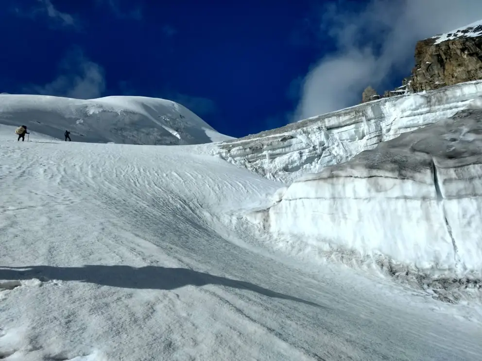
Mayali Pass
Speak to our expert Trek Advisors to help you choose the right trek.
Have Questions About This Trek?
Send us your enquiry and we'll get back to you soon.
About This Trek
The regions of Garhwal and Kumaon together forming gorgeous and venerable Uttarakhand hills, are known for their holy pilgrimage sites which attract many people from around the world. The two popular sites among these hills are Gangotri and Kedarnath, connected via. two challenging and beautiful treks Mayali Pass and Auden?s col. Mayali Pass Trek is one beautiful trek in the Garhwal Himalayas that was once used by pilgrims for their foot travels from Gangotri to Kedarnath. Still today, the trek is one of the most isolated walks on the trails you will find in the Himalayas. The Beauty of the trek lies in all its streams, high altitude lakes, and glaciers en route. The must-to-do itinerary includes one-day acclimatization stay at 4000 meters before attempting the Pass that leads you to Khatling Glacier. Apart from the high altitude pass, additional perks of the trek are an opportunity to witness two holy lakes Masartaal and Vasuki Taal. It takes you through dense mixed Himalayan forests, grassy meadows, shepherd encampments, and extremely remote villages providing dramatic views of the high mountains including Mt. Thalaysagar, Kedardome, Bhartekuntha.
Best Time to Visit
The best time for this trek is during May to June when the weather is pleasant and the views are clear.
Trek Details
Start Point
Guttu
End Point
Kedarnath
Pickup Location
Rishikesh
Drop Location
Rishikesh
Health & Safety
- For any Himalayan Trek, Ideal BMI for a trekker should be 18.5 to 24.9
- To keep a check of this please calculate BMI here
- Below given Safety checks should be done to get prepared for any Himalayan Trek.
- Balance : As well said a balanced mind and body gives out best in every condition and that too works in Himalayan treks as well.
- Legs Strength : Body and Legs Strength is required to carry body weight as well as the backpack while trekking in uneven multi terrains. Generally, a good strength on legs works out good in any Trek. One can gain legs strength by doing simple Squats.
- Muscle Flexibility : While trekking in Trans Himalayan region with a flexible body one can easily achieve full range of movement and this can be really helpful for trekkers as well as trek leads. A good flexible will be an advantage while walking on trails, climbing and river crossing etc. Flexibility can be achieved by simple stretching, yoga etc.
- Cardiovascular Endurance : Cardiovascular endurance is defined as the ability of lungs and heart to transmit oxygen to the body muscles. All Himalayan treks are basically ascending descending the slopes and for this trekkers should be having a good cardiovascular endurance. Anyone planning for a Himalayan trek can attain this capacity by doing any cardio exercise like running, swimming, cycling etc.
Speak to our expert Trek Advisors to help you choose the right trek.
Have Questions About This Trek?
Send us your enquiry and we'll get back to you soon.
Have Questions?
Speak to our expert Trek Advisors to help you choose the right trek.